Homepage of Daniel S. Brogan
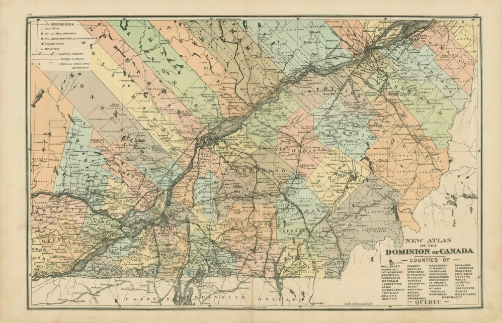
1881 Map of Quebec, Canada
Below is a map of a portion of Quebec, Cananda from the "Illustrated Atlas of the Dominion of Canada"
prepared under the direction of D. Macdonald, published by H. Belden & Co., Toronto, Cananda, 1881, pp.48-49.
Northwest Section @ 300dpi |
North Central Section @ 300dpi |
Northeast Section @ 300dpi
Southwest Section @ 300dpi |
South Central Section @ 300dpi |
Southeast Section @ 300dpi
Counties Included: Argenteuil, Arthabaska, Bagot, Beauce, Beauharnois, Bellechasse,
Berthier, Brome, Chambly, Champlain, Chateauguay, Compton, Dorchester, Drummond, Hochelaga, Huntingdon, Iberville, Jacques Cartier,
Jolliette, L'assomption, La Prairie, Laval, Levis, Lotbiniere, Maskinonge, Meoantic, Missisquoi, Montcalm, Montmagny, Napierville,
Nicolet, Richelieu, Richmond, Rouville, Shefford, Sherbrooke, Soulanges, St Hyacinthe, St John, St Maurice,
Stanstead, Terrebonne, Two Mountains, Vaudreuil, Vercheres, Wolfe, Yamaska